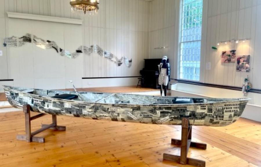
Teionontatátie, “a river flowing through a mountain,” was once the dominant means of travel and fishing by the Haudenosaunee people. Named after the Mohawk tribe, the headwaters of this river are located between the southwestern portion of the Adirondack Mountains and the eastern edge of Tug Hill Plateau. From here the river flows 140 miles southeast before joining the Hudson River in Cohoes. The Mohawk is one of the most modified rivers in the United States, with a freeway on one bank, a railroad on the other, nine moveable dams, five permanent dams, and five hydropower plants through its spine affecting its flow and depth. Perhaps most significant, it was altered to accommodate the Erie Canal which, upon completion, became obsolete with the advent of the railroad. This river has been polluted by industrial waste, abundant raw sewage overspills, nitrogen, and road salt and serves as the muse for the Environment and Sustainability course, “Art & Science of the Mohawk River” taught by Dr. Anna Davidson. This class explores the river, watershed and its people through multiple lenses from publicly engaged art, toxicology, hydrology, industrial history, geography, geology, and indigenous history. Each student was tasked with creating a place-based independent art project in addition to working on one large community-engaged project. The class concludes with art exhibitions in the rural communities in which students engage.
Collaborator:
Dr. Anna Davidson, Department of Natural Resources and the Environment