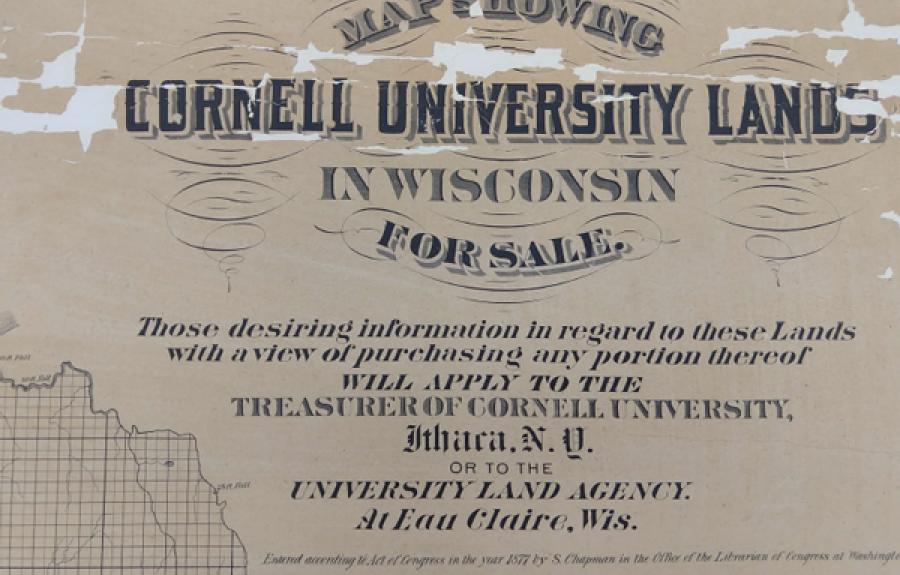
The goal of this data visualization project is to utilize new technology to tell an old story in a new way. The history of Cornell University’s engagement with “public lands” in the current states of Wisconsin, Minnesota, and Kansas has been the subject of descriptive historical narration for over a century. The University’s most valuable pine timberland holdings in Wisconsin were mapped and advertised for sale in 1877. University-produced statistical tables present a cumulative stark cost/benefit breakdown over time – the raw numbers are no mystery. Cornell University received nearly 10% of all federal lands distributed by the Morrill Act of 1862. Sixty years later, Cornell University claimed nearly 33% of all revenues realized by the nation’s land-grant universities for itself. Yet like all abstractions, the ways in which this history has been represented to date excludes key details essential to a fuller understanding of how Cornell University acquired these lands, managed them as a real-estate investment for nearly seventy years, applied the profits taken to building the University’s physical plant and institutional capacities, and simultaneously left behind a substantial legacy of negative impacts on dozens of Indigenous communities whose birthright became the financial engine that converted a three-building land-grant university in upstate New York teetering on the brink of bankruptcy into a world-class institution of higher learning.
The project will employ a variety of techniques for making appealing and convincing representations of digital data regarding Cornell’s “Land-Grab” status- past, present and future. Using parcel-level data for the lands in conjunction with institutional archival data concerning finances and building construction, the data visualization project will facilitate an interactive representation in simulated real time of the flows of capital to and from the University from 1864 to the present. Beginning with Ezra Cornell’s initial purchases of Morrill Act scrip in 1864, the project will detail the process by which Mr. Cornell’s investment in these lands began yielding incredible returns after 1881. Users of the online resource will be able to see the story carried forward to the sale of the University’s last remaining parcel of land in Wisconsin in 1938, and to assess the financial capital that continues to accrue to the University to the present day as a result of these activities. Users will also see the contrasting story of how the Indigenous nations experienced the effects of Cornell University’s active dispossession of their former homelands, including dispersal from those territories, confinement on reservations, environmental changes resulting from deforestation, denial of treaty-guaranteed rights to hunt, fish, and gather resources on ceded lands, and subjection to federally-sponsored programs of cultural assimilation (e.g., boarding schools).
The research team involved in this project will produce deliverables including a web-based platform that hosts both the Cornell Land-Grab interactive visualizations and an information repository containing raw and post-processed archival data. We envision providing a toolbox of techniques for analyzing and representing information, exploring new ways of making visualizations interactive, and enhancing the understandability of visualizations (primarily in educational settings). Ultimately, the objective of the project is to use these visualizations to promote an enhanced understanding of the history of the University’s engagement with Morrill Act lands and to promote a long-overdue institutional conversation regarding Cornell University’s responsibilities in light of this information.
Collaborators
-
Jon Parmenter (History)